
News Summary
Chatham County is currently under a tornado watch due to severe thunderstorms affecting the Savannah area. Residents are advised to take precautions as conditions could produce tornadoes. The National Weather Service warns of significant impacts in areas including Midtown Savannah and Coffee Bluff. While a thunderstorm capable of producing a tornado was detected, there is currently no active warning. Hurricane Helene is contributing to the severe weather, which has caused power outages for thousands. Local schools canceled classes on Friday for safety.
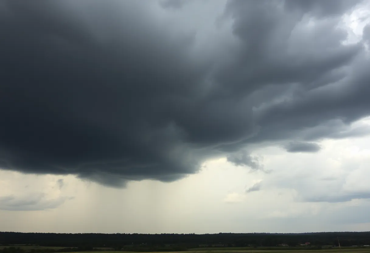
Savannah, Georgia — Portions of Chatham County are currently under a tornado watch due to severe thunderstorms affecting the Savannah area. The watch will remain in effect until 8:45 p.m. Saturday, as meteorological conditions indicate potential for tornado development.
The National Weather Service has identified several areas in Chatham County that may experience significant impacts from the storm. These include Midtown Savannah, Coffee Bluff, Windsor Forest, Wilmington Island, Hunter Army Airfield, Downtown Savannah, Montgomery, Vernonburg, Skidaway Island, and Isle of Hope.
Residents are advised to take precautions as strong thunderstorms are reportedly capable of producing tornadoes. The NWS warns of potential impacts such as tree damage and flying debris. It is recommended that individuals seek shelter in an interior room on the lowest floor of a sturdy building, away from windows. Those who are outdoors, living in mobile homes, or in vehicles should locate the nearest substantial shelter to avoid injury from debris.
A particular thunderstorm that could produce a tornado was detected near Montgomery, Chatham County, close to Vernonburg and Pin Point at approximately 7:58 p.m. While tornado sirens in the region were activated, the Chatham Emergency Management Agency clarified that this was due to a technical error, and there is currently no active tornado warning for Chatham County.
The severe weather is partly a result of Hurricane Helene, which has brought tumultuous weather across the southeast, including tornado watches and a flood warning for parts of Chatham County and nearby regions. On Friday, watches were issued for central and eastern North Carolina as well as parts of South Carolina and Virginia, alongside multiple tornado warnings throughout the day.
As a consequence of the hurricane’s impact, strong winds and heavy rainfall have caused power outages across the area, with approximately 2,200 customers in Orange County and 531 customers in Chatham County reported to be without power as of 3 p.m. on Saturday. Local schools in both Orange and Chatham counties canceled classes on Friday to ensure the safety of students and families during the dangerous weather conditions.
Duke Energy has requested that residents facing power issues report them through official channels rather than utilizing 911, to preserve emergency lines for urgent matters. This precaution allows emergency services to respond more effectively to those in need.
Hurricane Helene was classified as a Category 4 hurricane when it made landfall in Florida and is expected to weaken as it continues its path toward North Carolina. Monitoring and updates regarding the weather conditions and the implications of the hurricane’s aftermath remain a priority for local agencies as they urge residents to stay informed and prepared.
Deeper Dive: News & Info About This Topic
HERE Resources
Severe Weather Approaching Georgia: What You Need to Know
Savannah Weather Update: Prepare for a Chilly Week Ahead
Additional Resources
- Savannah Now: Tornado Watch in Chatham County
- Google Search: Chatham County tornado watch
- WTOC: Chatham Co. Tornado Sirens Activated
- Wikipedia: Tornado
- Chapelboro: School Closures in Chatham County
- Encyclopedia Britannica: Hurricane
- WSAV: Severe Weather Update Chatham County
- Google News: Severe weather Chatham County
- AJC: Tornado Threat from Hurricane Helene
- Google Scholar: Tornado watch Chatham County


