
News Summary
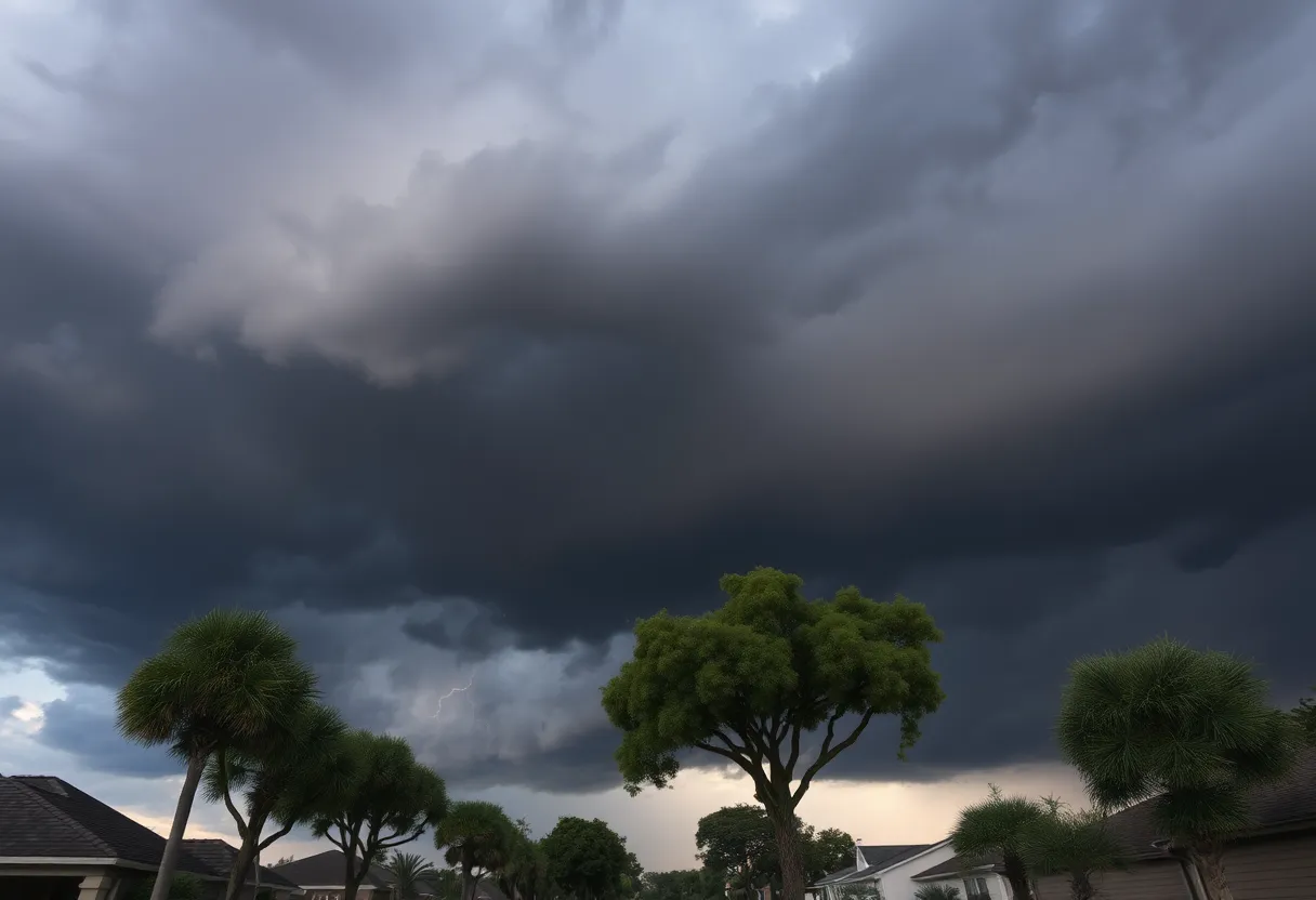
The Savannah Metro Area is experiencing severe thunderstorms and a tornado watch this weekend, with a 90% chance of rain. Chatham County remains under a tornado watch until 8:45 p.m. Saturday, emphasizing safety needs for residents, especially those in affected neighborhoods. Tornado conditions have been reported, and citizens are advised to seek shelter. Expected rainfall could lead to localized flooding, following heavy rains that have already caused road damage in nearby areas. Local residents must remain informed and prepared as further severe weather approaches.
Savannah
Severe thunderstorms and a tornado watch are currently impacting the Savannah Metro Area this weekend, with a 90% chance of rain expected throughout the day. Chatham County is under a tornado watch until 8:45 p.m. Saturday, prompting safety concerns for local residents.
Today’s high temperature is forecasted to reach 88°F, accompanied by southwest winds at speeds of 10 to 15 mph. The storms are anticipated to develop in the morning, transitioning to partly cloudy skies by the afternoon. Tonight’s low is expected to settle at 72°F, with west-southwest winds ranging from 5 to 10 mph.
The tornado watch affects several neighborhoods within Chatham County, including Midtown Savannah, Coffee Bluff, Windsor Forest, Wilmington Island, Hunter Army Airfield, Downtown Savannah, Montgomery, Vernonburg, Skidaway Island, and Isle of Hope. Residents in these areas are warned that possible impacts might include tree damage and flying debris as a result of severe weather.
Residents are advised to take safety precautions during this tornado watch. It is recommended that individuals seek shelter in an interior room on the lowest level of their homes, away from windows. Those who are outdoors or living in mobile homes should find more substantial shelter for their safety.
At approximately 7:58 p.m., a thunderstorm capable of generating a tornado was detected in Montgomery, Chatham County, near Vernonburg and Pin Point, further emphasizing the urgency for residents to stay informed and prepared.
The severe weather is expected to extend into Sunday night and Monday, which have been designated as WJCL Impact Days, focusing on the likelihood of scattered thunderstorms and heavy rainfall. Forecasts indicate an additional accumulation of rain may range anywhere from half an inch to over two inches, which could lead to more concerns regarding flooding.
Recent heavy rains have already resulted in washed-out roads and localized street flooding in certain areas, particularly in northern Tattnall County, which experienced up to 10 inches of rain. As a result, the highest chance for rain on Monday is anticipated during the morning hours, raising the risk for localized flooding incidents across the region.
After the intense weather pattern, afternoon showers and thunderstorms are expected to become more isolated on Monday as the day progresses. Following this system, a drier weather pattern is predicted to set in overnight on Tuesday. However, isolated showers or thunderstorms may still occur during the afternoon hours.
Looking beyond the immediate forecast, hot and humid conditions are predicted for later in the week. High temperatures could reach into the 90s, potentially leading to increased heat-related concerns for residents.
As the Savannah Metro Area navigates through this severe weather situation, local residents are urged to remain vigilant and stay updated on the latest weather warnings and advisories. With the storm conditions in mind, ensuring safety and preparedness is of utmost importance.
Deeper Dive: News & Info About This Topic
HERE Resources
Savannah Ranks as Top Retirement Destination
Savannah State University Graduation Ceremony Set for 2025
Tornado Watch Issued for Chatham County Amid Severe Storms
Severe Flooding Hits Savannah, Leading to Road Closures
Savannah Launches 30th Season of Antiques Roadshow
Radar Trouble at Newark Airport: Another Outage Shakes Air Travel
Savannah Hosts 12th Annual State of Small Business Conference
Georgia Launches Georgia Grown Market to Support Local Farmers
Savannah Celebrates Cinco de Mayo with Community Events
Disney’s Financial Outlook for This Quarter
Additional Resources
- Savannah Now: Tornado Watch
- Wikipedia: Thunderstorm
- WJCL: Heavy Rain and Storms
- Google Search: Tornado Savannah
- WJCL: Thunderstorms and Heavy Rain
- Encyclopedia Britannica: Tornado
- Savannah Now: Abercorn Street Closure


