
News Summary
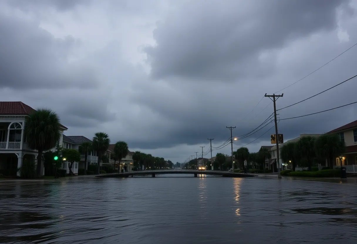
Savannah is under a Flood Watch due to heavy rainfall expected today. Residents are advised to be cautious as localized flooding poses risks amid up to 5 inches of rain. The heavy downpour will likely occur closer to the coast, with additional concerns for weak waterspouts. Morning temperatures are in the mid 70s and are projected to rise to the lower 80s. A stationary front may lead to more isolated showers later this week, while Tropical Storm Invest 97-L could strengthen into a storm in the coming days.
Savannah, Georgia is currently under a Flood Watch until 6 PM today due to heavy and persistent rain showers that are expected to increase the risk of localized flooding across coastal counties. Residents are advised to remain vigilant as rainfall rates of 1 to over 2 inches are anticipated, with some areas possibly receiving a total of 3-5 inches by the end of the day.
The heaviest rainfall is predicted to occur this morning, particularly closer to the coast, with bands of intense rain expected to extend up the Savannah River. This weather pattern may also pose a potential risk for weak waterspouts making landfall during early morning hours, bringing additional concerns for coastal residents.
As the day progresses, morning temperatures started in the mid 70s and are forecasted to rise to the lower 80s by lunchtime. Despite the rain, typical scattered showers and thunderstorms are anticipated this morning, which will become more isolated by the afternoon and evening. The high temperature today could reach the mid 80s, making it one of the cooler days in the week ahead.
A stationary front currently contributing to the increased rainfall is expected to move south by Tuesday, although isolated shower activities may still persist along the coast. Afternoon temperatures will likely rise again, reaching the upper 80s to lower 90s, resembling conditions expected throughout the week.
Wednesday is projected to share similar weather characteristics with morning lows in the mid 70s and highs nearing 90 degrees. During this time, the effects of rain are expected to be predominantly influenced by the afternoon sea breeze. Over the course of the week, weather patterns will start to trend towards warming, with less widespread rain predicted heading into the weekend.
By the end of the week, temperatures are expected to climb into the lower 90s, and the heat index could potentially reach around 105 degrees in the afternoons, nearing the thresholds for a Heat Advisory. Despite these rising temperatures, the weekend will likely maintain highs near 90 degrees with afternoon thunderstorms and showers remaining a possibility.
In addition to the local flooding concerns, Tropical Storm Invest 97-L is on the radar, with expectations of intensifying into a storm named “Erin” within the next 48 hours as it drifts westward across the Atlantic Ocean. The future trajectory of this system remains uncertain and will be largely dictated by the positioning and strength of nearby high-pressure systems.
Residents and tourists in Savannah are urged to exercise caution and remain informed about ongoing weather changes as well as the risks associated with flash flooding. Preparations and awareness are key as the weather can shift rapidly, impacting travel and outdoor activities.
As always, keeping an eye on weather updates will play a crucial role in ensuring the safety and preparedness of those in the affected areas, especially during this unpredictable season of heavy rain and rising temperatures.
Deeper Dive: News & Info About This Topic
HERE Resources
76 FENCE Expands with New Locations in Georgia
Severe Thunderstorms to Impact Savannah Region
Severe Weather Threat in Savannah this Weekend
Savannah Named One of the Dreamiest Coastal Cities
Savannah Weather Outlook: Pleasing Days Ahead, Rainy Week Expected
Severe Thunderstorms and Tornado Watch in Savannah Metro Area
Tornado Watch Issued for Chatham County Amid Severe Storms
Severe Flooding Hits Savannah, Leading to Road Closures
Concerns Over DOJ’s Antitrust Case Against RealPage and AI Innovation
Tax Filing Deadline Extended for Georgia Residents Affected by Hurricane Helene
Additional Resources
- WSAV: Coastal Flood Watch Issued
- Wikipedia: Flood
- Travel and Tour World: Flood Threats in August
- Google Search: Flash Flooding Preparations
- WJCL: Impact Day Rain Likely
- Google Scholar: Flood Watch Preparedness
- Savannah Now: Flood Preparation Steps
- Encyclopedia Britannica: Flood


