
News Summary
Savannah, Georgia is under a Flood Watch from Friday morning to early Sunday due to a cold front bringing heavy rain and thunderstorms. Rainfall totals of 2-4 inches are expected, with potential flooding affecting evening plans, including local football games. Residents are advised to avoid flooded roadways and heed safety warnings. Conditions may improve by Sunday, but another cold front could bring more storms next week.
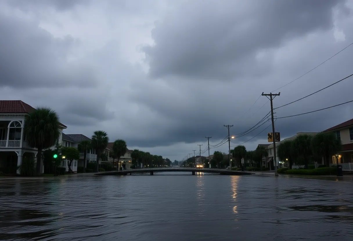
Savannah, Georgia is under a Flood Watch from 8 AM Friday until 2 AM Sunday due to an upcoming weather system expected to bring heavy rain and thunderstorms to the area. Forecasts predict rainfall totals between 2-4 inches, with some areas possibly experiencing higher amounts.
The weather change stem from a cold front moving in on Friday, which will significantly increase the likelihood of showers and storms starting in the afternoon. As a result, residents should anticipate heavy rainfall, with rates potentially exceeding 2-3 inches per hour. This could lead to isolated instances of flooding throughout the region. The anticipated rainfall could greatly impact Friday night’s plans, including local football games, as communities may see 2-4+ inches from Friday afternoon through the evening.
On Friday, afternoon temperatures are expected to reach the upper 80s. The cold front is predicted to linger over the area, continuing the wet conditions into Saturday. Morning showers are likely on Saturday, but the best chances for rain are forecasted to occur during the afternoon hours. Saturday’s high temperatures are expected to drop slightly, reaching the low to mid 80s.
The Flood Watch will remain active throughout Saturday. Residents are advised to stay off the flooded roadways if conditions worsen. It is worth noting that it only takes 6 inches of moving water to sweep a person off their feet, 12 inches to float a car, and 18 inches to float a pickup truck, emphasizing the importance of heeding safety advice during this period of heavy rain.
On Sunday, scattered showers are expected to continue, but the Flood Watch will expire at 2 AM. Weather conditions should start to improve, with Sunday expected to be drier than the preceding days and high temperatures in the mid to upper 80s.
Looking ahead to the start of next week, temperatures are predicted to rise back into the lower 90s on Monday. However, another cold front may arrive, bringing additional showers and storms on Monday afternoon and evening. By Tuesday, drier and slightly cooler conditions are expected, with morning lows around 70 degrees and highs near 90 degrees. A more stable dry condition is forecasted for Wednesday, featuring morning lows in the upper 60s and highs around the mid 80s.
In the larger context of weather events, the current season has seen a record number of flash flood warnings issued across the United States, the highest observed since the 1980s. As of now, there have been 3,466 warnings issued across the continental U.S., largely attributed to the neutral state of the El Niño-Southern Oscillation (ENSO), which has resulted in a scenario where storm systems move slower and bring warmer, more moist air.
In terms of flood types that impact the Coastal Empire and Lowcountry, three categories are recognized: coastal flooding, urban flooding, and rural flooding. These classifications help communities prepare and respond to flooding incidents based on their specific vulnerabilities.
As Hurricane Erin, currently a Category One storm with sustained winds of 90 miles per hour, continues to weaken while moving northeast, meteorologists are monitoring several areas of potential tropical development. While there are no immediate threats to the U.S., an area of showers northeast of the Leeward Islands has a high chance of developing into a tropical depression, and another disorganized system between Cabo Verde Island and the Leeward Islands has a medium chance of development over the next two days.
As the weather continues to evolve, residents are urged to stay informed and prepared for potential flooding and storm conditions throughout the weekend and into early next week.
Deeper Dive: News & Info About This Topic
HERE Resources
Savannah Braces for Extreme Heat and Hurricane Erin
Hurricane Erin Intensifies to Category 5 as Coastal Georgia Prepares
Savannah Under Heat Advisory as Temperatures Soar
Flood Watch Issued for Savannah, Georgia
76 FENCE Expands with New Locations in Georgia
Severe Thunderstorms to Impact Savannah Region
Severe Weather Threat in Savannah this Weekend
Savannah Named One of the Dreamiest Coastal Cities
Savannah Weather Outlook: Pleasing Days Ahead, Rainy Week Expected
Severe Thunderstorms and Tornado Watch in Savannah Metro Area
Additional Resources
- ABC News: Hurricane Erin Tracker
- Wikipedia: Flood
- ABC 7 Chicago: Severe Thunderstorms
- Google Search: Severe Thunderstorms
- NBC Chicago: Storms Possible in Chicago Area
- Encyclopedia Britannica: Weather
- WSAV: Flash Flood Warnings
- Google News: Flash Flood Warnings
- Savannah Now: Preparing for a Flood
- Google Scholar: Flood Preparedness

Author: STAFF HERE SAVANNAH WRITER
The represents the experienced team at HERESavannah.com, your go-to source for actionable local news and information in Savannah, Chatham County, and beyond. Specializing in "news you can use," we cover essential topics like product reviews for personal and business needs, local business directories, politics, real estate trends, neighborhood insights, and state news affecting the area—with deep expertise drawn from years of dedicated reporting and strong community input, including local press releases and business updates. We deliver top reporting on high-value events such as Savannah Music Festival, St. Patrick's Day Parade, and Savannah Jazz Festival. Our coverage extends to key organizations like the Savannah Area Chamber of Commerce and United Way of the Coastal Empire, plus leading businesses in aerospace, education, and logistics that power the local economy such as Gulfstream Aerospace, Savannah College of Art and Design, and Colonial Group. As part of the broader HERE network, including HEREAtlanta.com and HEREAugusta.com, we provide comprehensive, credible insights into Georgia's dynamic landscape.