
News Summary
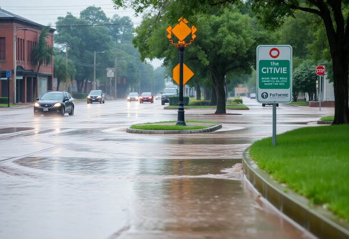
Savannah is grappling with heightened flood risks as heavy rainfall this hurricane season overwhelms outdated flood hazard maps. With the National Weather Service predicting more intense storm events, city officials highlight the inadequacy of FEMA’s flood maps, which have not been updated since 2018. Recent developments in the region have altered natural runoff patterns, exacerbating the flood risk. As a response, the Savannah Water Resources Department is improving stormwater management in preparation for ongoing rainy conditions.
Savannah is facing increased flood risks due to outdated flood maps and the impact of heavy rainfall this hurricane season. Nearly two months into the season, the city has experienced between 4 to 7 more inches of rain than usual, contributing to a heightened risk of flooding. According to Tom McDonald, the City of Savannah Flood Plain Administrator, regions in and around Savannah are becoming increasingly saturated.
The National Weather Service has indicated that the likelihood of more frequent and intense wet storm events will continue to rise, leading to a higher probability of flooding in urban areas. This is particularly concerning for cities such as Savannah, which depend on the Federal Emergency Management Agency (FEMA) for flood hazard maps to gauge flood risks and prepare accordingly.
FEMA’s flood hazard maps for Chatham County have not been updated since 2018. As a result, they do not accurately reflect the current landscape or the changes that recent development projects have brought to the area. In addition, Georgia scientists and weather forecasters have observed a trend of warming oceans and atmosphere, signifying that storms are now more potent and capable of carrying greater amounts of rainfall. The Atlantic Ocean’s temperatures are currently between 2° to 5° F warmer than average, further escalating the risk of flooding.
Flood hazard zones are designated areas where flooding is most likely to occur and can be accessed through the Savannah Area Geographic Information System (SAGIS). However, these maps, developed back in 1991, rely on outdated data from FEMA’s last release. The current flood zones fail to accurately represent evolving risks as flooding events begin to take place outside recognized hazard areas. Significant developments, including over a thousand acres of industrial space created since 2020, have worsened local flooding issues, as the new constructions alter natural water runoff patterns.
Recent flooding incidents, such as those experienced during Hurricane Debby, have highlighted the inaccuracies in FEMA’s maps, which did not meet the city’s planning needs. In light of this, city officials warn residents to avoid driving through flooded areas and to seek alternate routes for safety during particularly rainy weather.
To combat these issues, the Savannah Water Resources Department is focusing on optimizing the city’s stormwater drainage system, learning from past flooding events. The city has implemented a more refined stormwater management routine, adding resources in preparation for the storm season. Currently, Savannah manages approximately 416 miles of stormwater pipes alongside 147 miles of canals and ditches, with around 60% of the drainage system having been inspected to identify and address potential problems.
Savannah has received over $125 million in funding for capital projects aimed at enhancing stormwater management capabilities. Moreover, officials underscore the importance of keeping storm drains clear of debris, as blockages can exacerbate flooding. To address these ongoing issues comprehensively, there are discussions about implementing a dedicated user fee intended to fund stormwater projects equitably based on property runoff contributions.
Community engagement meetings have been organized to inform residents about potential new fees for stormwater management. The Savannah Water Resources Department continues to advocate for increased resources within the city budget to boost maintenance capabilities, including the procurement of additional jet-vac trucks for efficient stormwater upkeep.
As hurricane season progresses, the city remains vigilant in its efforts to better prepare and manage the risks associated with flooding due to changing weather patterns and outdated hazard assessments. Ensuring the safety and resilience of Savannah’s infrastructure will be critical as more extreme weather events become an ongoing reality.
Deeper Dive: News & Info About This Topic
HERE Resources
Severe Weather Threat in Savannah this Weekend
Thomas & Hutton Expands Savannah Office with New Hires
Savannah Faces $60 Million Reduction in SPLOST Allocation
Savannah Plans Town Hall Meetings on Community Projects
Savannah Considers New Stormwater Utility to Tackle Flooding
Savannah Launches Survey for Upcoming SPLOST Tax Referendum
Savannah Prepares for Community Meetings on Stormwater Utility
Traffic Trouble in Savannah: A Closer Look at Rising Incidents
Savannah and Charleston Collaborate for Community Growth
Georgia Senate Passes Bill Protecting Pesticide Manufacturers
Additional Resources
- Savannah Now: Savannah Needs New Flood Maps
- Wikipedia: Flood
- WTOC: Savannah Locals React to Recent Flooding
- Google Search: Savannah flooding
- New York Times: Hurricane Debby Updates
- Encyclopedia Britannica: Hurricane
- Savannah Now: Experts Talk Lessons Learned for Storm Season
- Google News: Savannah storm season


